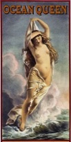
Raitt Master Mariners
New information I have come across sheds much more light on the competency and voyages of our master mariner ancestors, including my great grandfather David Dorward Raitt and his brother James Dorward Raitt, their father John Raitt and his brother Alexander, as well as other relations (such as the latters’ sister Susan’s husband Alexander Croal; and Alexander’s son Alexander) and this is to be found on their respective pages. Some of them actually sailed on the same ships, though not at the same time. There are also other Raitts, as well as other relatives, such as the Stormonts, from Arbroath who were mariners and I have included their details on a separate page. There are also a couple of other Raitts who are documented - they are not from Arbroath and thus not (direct) relatives, but I have thought it useful to include a page about them since their careers shed even more light on what it took to be a master mariner (see Other Raitt Mariners). These were all clearly men of great prowess, intelligence, skills, knowledge and experience, as well as being superbly fit, and they had to pass extensive examinations to become ship masters.
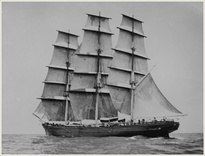
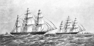
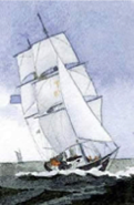
However, it is worth exploring and discussing just what this might have entailed to be a seaman in the days of sail nearly 200 years ago. We can imagine John Raitt threading his way through the 474 islands in the Danish straits before he reached the Baltic. We can picture his sons, James and David, reaching speeds of over 15 knots on a good day on their China trade trips. The ship David was on, the J. M. Joshua, probably didn’t take part in the Great Tea Race of 1866, although it was certainly in the area at the time and was heavily damaged in the South Atlantic presumably in a storm (see the page on Raitt Wrecks).
The China clippers (such as the well-known Cutty Sark) were acknowledged as the fastest sail vessels when fully rigged and with a favourable trade wind. The Great Tea Race took place with a number of ships leaving China at the same time in June 1866 and after a voyage of three months, several managed incredibly to arrive in London in September within minutes of each other. The vessels – most likely in full sight of each other all the way - had crossed the South China Sea, sailed through the Sunda Strait in Indonesia, across the Indian Ocean, round the Cape of Good Hope, up the Atlantic Ocean, through the English Channel and down the River Thames where they were towed to Gravesend. The race was an unofficial competition between the fastest clippers of the China tea trade to see which ship would be the first to bring the season’s first crop of tea to London.
Reports in the press constantly mentioned the weather. We can read that on her voyage in summer 1915 back from Canada, the Ceres, under David Raitt, experienced a tremendous storm during the night; as also afterwards, during the passage, very rough blowing weather. On another occasion, the Ceres experienced very blowing weather, and being put far to the northward, met with a deal of large ice before making the neighbourhood of St John’s, Newfoundland. In Lloyd’s Marine List for 11 Jan 1813 there was a report carried of damage to shipping in the Targus (Lisbon area) during a violent gale of wind at WSW on 19 th ult. (i.e. December 1812) and the Amphitrite, under master Raitt, was driven ashore and bilged.
And it was not only the elements that the merchant seamen had to contend with. They were attacked, chased and harried, even captured by naval warships as well as privateers during the American War of Independence, the Napoleonic War and also the Anglo-American War of 1812. The Amphitrite, for instance, (whether this is the same ship (and master) as above is not clear) was mentioned in a letter from Gibraltar dated 24 July 1810 as being taken by one of the 24 privateers, mostly commanded by “worthless Genoese which cruize between Oran and Bona”. The press also gave some illuminating details of the fate suffered by merchant Captains Charles Raitt of Dundee and David Raitt of Aberdeen (see under Other Raitt Mariners), as well as some of the daring exploits of Captain William Raitt, RN - also of Aberdeen (see under Military Raitts).
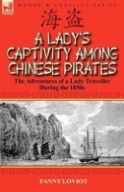
In this respect it is worth mentioning a little book first published 1858 entitled A Lady’s captivity among Chinese pirates in the Chinese Seas. A young Frenchwoman, Fanny Loviot, describes in a vivid and gripping account, the events that overtook her in October 1854 when the merchant ship on which she was travelling was captured by pirates. The book gives an excellent perspective into not only how merchant ships plying Chinese waters were prone at any time to be pursued, boarded and looted by pirates, but also the miseries of lengthy voyages with their attendant storms, men lost overboard, lack of fresh food and water. Our ancestors were undertaking such trips precisely at the time Fanny’s ship was captured and her story gives an insight into the hazards and dangers they constantly faced.
No doubt they also had to have a basic grasp of maritime law (including the Merchant Shipping Act of 1854) – perhaps from perusing “The Law relating to Shipmasters and Seamen”. An item in the Brisbane Courier for 30 November 1865 picked up a piece from the Auckland Southern Cross which commented:
“Another instance of the injustice done to the shipowners by the imposition of the present exorbitant light dues has come under our notice. The British merchant ship J. M. Joshua, put into this port (Port Moresby) last week on her way from China to Callao, for the purpose of obtaining medical comforts and a supply of fresh provisions. On the captain reporting his vessel (which is only in ballast and on her way to Callao to load guano for Foo-Chow-Foo) at the Customs at Auckland, a sum of £30 for light dues was demanded. This we consider a case of great hardship, and we trust that the necessary action will be taken to exempt vessels under such circumstances from the payment of anything like the full rate paid by vessels trading to this port.” The J. M. Joshua was the ship David Dorward Raitt was on at the time.
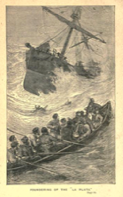
And a report in the Sydney Morning Herald for 22 September 1866 reports the following (also picked up by other newspapers.) which shows the perils that seamen often faced daily.
“On June 19th, off the Cape de Verde Islands, the Challenger picked up a boat with Mr Jones (second mate) and 5 men, of the ship Severn, of London, coal laden, from Newport to Shanghai; Mr. Jones's statement was the following –
"On June 15th, the ship leaking badly, and the crew being worn out with pumping, all hands took to the boats, the master of the ship taking charge of the long-boat, the chief mate the gig, and the second mate in the small gig. The two first- named boats were lost sight of in the course of the night, and then the boat's head was put to the eastward, with the intention of fetching one of the Cope de Verdes" As the weather was fine and the boats being not for from the land, there is every probability of their having arrived in safety, if they were not previously picked up by outward-bound ships. On June 29th, in latitude 6 S., longitude 32 W., the ship J. M. Joshua was spoken with, standing to the northward, with a jury-foremast and bowsprit, and apparently damaged about the bows.” Again, my great grandfather David Dorward Raitt was on this last mentioned ship at the time.
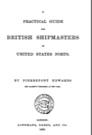
And for their forays to North America then they were probably familiar with the “Practical Guide for British Shipmasters to United States Ports” published in 1866. This interesting book gives details on wages, the conduct of the Master towards the crew (and vice versa), bills of lading, dismissal of seamen before earning a month’s wage, logbooks, medical stores, carrying letters, United States ports of entry and departure and so on.
----------
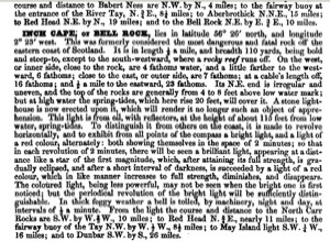
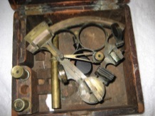
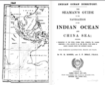
For the navigation side of things they would have had to be able to read and understand maps and charts and been comfortable handling a compass and sextant, they undoubtedly knew how to navigate also by the stars. They might have studied an earlier version equivalent to “The Mate’s Companion, or Navigation as Practised at Sea” first published in 1883 which covered rules and examples worked out of all the shortest sea methods as well as nautical astronomy and tables required to find the latitude of the pole star and longitude at sunrise and sunset. And they would have been familiar with the various light houses and fog horn signals around the coasts. Both David Dorward Raitt and his brother James may well have boned up on “The Seaman’s Guide to the Navigation of the Indian Ocean and China Sea” (1867) – which, besides giving helpful advice on what to do in typhoons and accosting icebergs, also lists an astonishing number of books for the seaman on every topic and location under the sun, including guide books for taking the exams for Certificates of Competency – which he and his brother and father, uncle and cousins would surely have studied.
James Dorward Raitt was wrecked off the Swedish coast in a storm - a story reported in the local press as well as by his wife, Elizabeth Abbott. The book of sailing directions gives a flavour of the conditions to be encountered. For example:
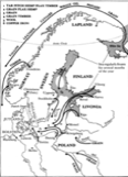
General Observations and Directions /or sailing over the North Sea.
The banks in the North Sea are large portions of ground somewhat shoaler in general than the ground which surrounds them, and their depths, when carefully observed, often tend to inform the mariner, when doubtful, of his situation ; they are of irregular and undefined shapes, and commonly known by the names of the Brown Bank, the Broad Fourteens, the Wells Bank, the White Bank the Dogger Bank, the Great and Little Fisher's Bank, the Jutland Bank or Reef, the Long Forties, and other small banks; these are neither dangerous nor steep to, but generally rise by a gradual elevation, and their boundaries will best be Understood by the chart; the current over these banks is visibly affected by th6 winds, but in general inclines toward the N.E., a circumstance particularly necessary to be attended to, as tending to set the mariner, bound from the British shores toward the opposite coast, beyond his reckoning, and perhaps thereby endangering his vessel, by coming too soon upon those shoals which so generally line the shore: those therefore who sail from the westward, in order to make any part of the coast between the Texel and the Scaw, should look out for land in time, for it is very common in making it to find the distance from 20 to 30 miles less, than when sailing the contrary way in making the British coast; this particularly happens with south westerly winds, which, causing a constant current to the East and N. Eastward, generally sets across the Jutland Reef and the south side of the Sleeve towards the Scaw Point, or, varying its direction with the wind, bends to the westward towards the coast of Norway.
It is therefore particularly necessary to be cautious that the northerly current does not drive the ship a-head of her reckoning to the northward of the Jutts Reef, especially with S. and S.S. E. winds. The current along shore, above Bovenbergen, we have before noticed, sets with westerly winds, 2 miles an hour, and with strong
S. S. W. gales more than 3 miles.
A very deceiving current likewise sets between the Naze of Norway and the Orkney Islands, the knowledge of which is to the mariner the more important, some of these islands being, as before observed, very low, generally obscured from view by fog and mist in summer, and annoyed by the most powerful gales in winter. This current takes its course with the wind, particularly when it blows from the southward or northward, but generally it runs strongest to the northward. As the wind continues the current increases, and sometimes runs upwards of 2 knots midway between the Naze and Orkneys, after long-continued south-westerly winds.
----------
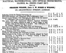
The above manual also provides adverts for the nautical instruments the mariners would have required at sea, such as sextants and telescopes. Such necessary equipment could take a goodly proportion of their salaries and were cherished possessions as the wife of James Dorward Raitt attested in her story of her husband’s shipwreck in Swedish waters.
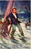
Here, for example, we have a note about Arbroath and some examples of the directions given and the dangers faced:
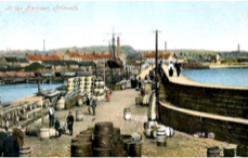
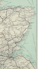
Aberbrothick is 6 miles from the Bar of the Tay, from which it bears N. E.; here is a dry but safe harbour. The Roadstead lies nearly a mile off the town, and has from 9 to 10 fathoms water; between Buttonness and Aberbrothick, you may run along in
12 fathoms with safety, a small distance offshore: the land from the Carr's-end to beyond Aberbrothick is low, flat, and sandy, 3 cables' length off. Aberbrothick has a remarkable old Abbey standing, near the west end of the town: from hence to Redhead is 5 miles; the shore between is high, rugged, and steep, with 14 fathoms close to it, and 16 fathoms further off: in this place stands the small fishing town of Auchmuthie.
----------
When bound for the River Tay, after you are round the Carr, steer so as to shun May Isle in behind Fife Ness; then continue with it just shut in, and bring Button Ness to bear N. N. W. half W. steering with it so, until the Tay Lights can be seen. When the great light comes to the eastward of a remarkable notch in Sedley Hills, at two hours flood, and the bar smooth, ships drawing 15 feet may steer right in for the lighthouse; keeping it open a ship's length E. of the notch, will lead close to the E. side of the buoy on the E. side of the entrance.
Be careful never to take the bar on a spring ebb, if possible to avoid doing so, for the tide is too strong, and will require a powerful wind to stem it.
As the water breaks from side to side of the entrance in bad weather, especially when the tide runs against the wind, strangers going in at such times must be attended with danger. Such should, if possible, keep May Island in sight eastward of Fifeness. which will keep them a large mile off the bar, until the flood tide is well made: and then run in, as before directed. If obliged to attempt the bar with an ebb tide and an easterly wind, carry very little after-sail, that the ship may the more readily answer her helm, when the tide, by taking her upon either bow, shall render such celerity necessary. Be careful, when over the bar, not to approach nearer to the Gun than the depth of 5 fathoms, nor to the Aberlay than 6 fathoms, as both these banks are steep. Off Red Head the tides run very strongly, and often cause a rough sea, especially when the stream sets to windward. In the night-time, or in hazy weather, come no nearer than the depth of 26 fathoms to this part of the coast: there are 20 fathoms within a mile of the shore.
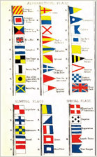
Our great grandfathers, like other sailors from time immemorial, particularly the master mariners, had to have an excellent knowledge of the different seas and their currents, the complicated wind patterns and strengths, seasonal variations in weather, the night sky and the like. The combination of winds and tides conditioned sailing routes in the time before steam and they would have known how to read the weather in times before there were regular forecasts and so wait until the gale season had abated. The sea could often be fog-bound and susceptible to sudden squalls (like the one that caused the death of Alexander Croal, John Raitt’s brother-in-law), and offshore winds and unexpected currents, not to mention submerged rocks near shore (like the ones that caught out James Dorward Raitt off the coast of Sweden and resulted in the death of three of his crew) meant that the mariner had to excel in navigation as well as seamanship – both during the night as well as by day. Ships were at sea for long periods and usually out of sight of land, so the ability to read the signs provided by clouds on the horizon, birds at sea and so on could prove vital. Indeed their Certificates of Competency were contingent upon them passing the required examinations in navigation, seamanship and commercial code signals.
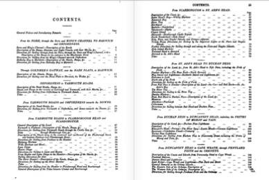
(I have given the introductory text relating to these examinations as outlined in “A Manual for the Use of Candidates Requiring a Certificate of Competency as Mates and Ordinary Masters” on the separate Requirements for Certificate of Competency page.)
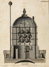
Although they would have learned much by trial and error, observation and experience during their careers as ship’s boy, apprentice, ordinary seaman, able seaman, mate and subsequently master, they would have had to have mugged up on the various manuals such as “Practical Seamanship” published 1862 or “The Seaman’s Manual” of 1841. They would have learned the names of the parts of a ship, the types of sails and riggings, knots and splices and rope making, blocks and tackles, log and lead lines, stowage and ballast, anchors and cables, how to manage the vessel, what to do if man overboard, the signal flags and a myriad other things. They may also have had a well-thumbed copy in their possession of “New and Extensive Sailing Directions for the Navigation of the North Sea” (2nd ed 1823) which provided descriptions of the various channels as well as instructions for sailing into all the bays, harbours and roadsteads on the Eastern coasts of England and Scotland, not to mention the shores of France, The Netherlands, Germany and Norway.
Turn around time in ports from leaving one ship to joining another was often just a couple of days – I suppose you went where the work was – either seeking a new berth or being offered it. But it left little time to see the family (wife or mother) between long trips. And what must a mother have felt to see her 11 or 12 year old son go to sea on a long voyage in a time when it was still pretty precarious. Was the family so in need of income that a child went to sea as opposed to working in the linen industry as a weaver. Was it one less mouth to feed? Did the lads jump at the chance to follow in their fathers’ footsteps – the thought of high adventure luring them away like a siren’s call? There is at least one story of a young lad’s epic voyages round the world in merchant vessels and also his later exploits in man of war ships.
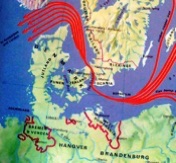
Most of the early Raitt mariners (and their relatives) were, at some stage, involved in the Baltic trade. The Tayside Maritime History website provides some interesting background.
“ Vessels from the Eastern Baltic rose from 46% of the foreign total in 1790 to over 76% of those entering Dundee in 1821. The flax growing regions north of Moscow, Yaroslavl, Kostroma and Vologda first exported through Archangel but, with the White Sea frozen over for half the year, switched to St Petersburg. However, merchants raising prices there and lack of quality control led to the growth of imports of flax from modern-day Estonia, Latvia and Lithuania. These came initially through Riga and later, from about 1830, Memel, Libau, Reval, Narva and Pernau.
The Napoleonic War and its aftermath allied with British protectionism hampered Tayside's ability to trade with Europe. The Corn Laws, not repealed until 1846, restricted imports from Germany and the Baltic. The French too resented British duties. Not only did these duties discourage other Europeans from buying Dundee's linen, it was also seen as poorer quality than that produced domestically.
The obvious market was North America but, from the East coast of Scotland, this meant a stormy six week voyage through the Pentland Firth or a wait in Kent for favourable winds through the English channel. This meant most cloth was shipped indirectly through Liverpool or Glasgow. Nevertheless, Quebec and Montreal accounted for a quarter of Dundee's linen and diaper exports in 1815 and this had tripled by 1829 with a small proportion going to St John. Building material and supplies shipped ranged from cement, iron and lead to paper, ink and a piano.
Articles from the Arbroath Guide show changing patterns of trade between 1881 and 1883. “The main imports to Arbroath from foreign ports were flax and hemp. Most came from Riga but significant amounts came also from Memel, Pernau, Kronstadt, Reval, Königsberg and Libau. The major change between 1881 and 1882 was the nationality of the vessels. In 1881 60% of those coming from foreign ports were British-owned. The next year this reversed with only 40% being British owned. In 1883 the cargoes and ports were generally the same but he volume had dropped considerably, around 50% in the case of flax.
An active coastal trade can also be seen with coal as the main landed cargo and potatoes and grain leaving Arbroath.”
Ports of call in the Baltic region may have included places such as: Gothenberg, Elsinore, Copenhagen, Stockholm, Lulea, Vassa, Helsinki, St Petersburg, Tallin, Riga, Gdansk. It is possible to get an idea of trade from other trips made by the same ship. Thus, for example, in 1830 the Gratitude (on which our ancestors servd at various times) registered in Dundee made over a dozen trips to places in England as well as abroad: North Shields to Stockholm carrying coal; Stockholm to Cronstadt carrying ballast; Cronstadt to London carrying iron and feathers; London back to Cronstadt carrying gum, wood (log wood), sugar, rum, tin, cotton, indigo, and paper; Cronstadt to Dundee carrying hemp – all within the space of six months.
----------
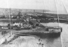
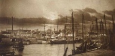
A letter to the Editor of the Guide, dated Arbroath, 17 September 1917 and signed “Another Old Stager” discusses shipping at Arbroath in the old days. The letter is of interest because it mentions several of the ships on which our ancestors sailed. The author states that he has followed all the “Old Stager” letters closely but they missed some prominent ships. The author can go back as far as nearly 60 years (which would place the date as around 1857 – the time when most of our great (great) grandfathers and relatives were active) and lists various ships, their types and their owners. Among those familiar to us are the Surprise, Bee, Eliza, the schooner Thomas, the Water Lily, the Rover, Hawk, Rosebud, the Favourite (captained by Raitt). The Baltic brigs were worth looking at when discharging flax – they included the Neptune and the Britannia. The sloops included Anna, Betty, Agnes. The Enterprise was wrecked at the bar, the Rover was wrecked at the back of the west breakwater.
We can also read in another entry that “A Baltic Brig was a solid two-masted, square-rigged vessel often with double or triple planking to withstand the pressure of ice. They were bulky ships usually painted black and tarred. Carragher describes the Hannah, 'She was black painted, tarred and with imitation port holes. As she also carried wood she had two square openings in her bows through which the wood was discharged. Her little, dimly-lit cabin with its sleeping bunks of wood from the Guynd with the tree barks outwards, its many brass-mounted lockers, its large swinging oil lamp and its ancient smell of tobacco is still dear to the memory. The biscuits were so hard and tough you could have played quoits without fracturing or discovering their composition. They were bought in Prussia or Russia and you could have soled boots with them'”.